Hay Production Decision Guide

Hay Drying Weather: Forecasts and Cutting Window Planning

The single most consequential hay production decision is the cutting window — when to mow relative to the weather that follows. Cut into a reliable 4-day window and the crop reaches baling moisture without rain contact. Cut on optimism and a worsening forecast and the same premium hay requires additional cuttings with heavy leaf loss, protein leaching, and possible mold development. This guide covers the specific weather variables that determine drying rate, how to read forecasts for hay decisions, and the regional patterns that shape cutting strategy across the U.S.

Drying Variables Explained

The Five Weather Variables That Control Drying Rate

Hay drying is a physical process — water in the cut crop evaporates at a rate determined by the vapor pressure difference between the crop surface and the surrounding air. Five measurable weather variables determine how fast that evaporation occurs. Understanding which variables matter most allows you to use a weather forecast as a drying rate prediction rather than just a rain-risk assessment.

Solar Radiation
Highest-impact variable. Drives evaporation by heating the crop surface. Cloud cover reduces drying rate by 40–70% vs full sun.
Relative Humidity
The lower the RH, the faster drying. Above 70% RH, drying nearly stops. Below 40% RH, drying is very fast.
Air Temperature
Higher temperature increases evaporation rate. 90°F drying is 2× faster than 65°F at equal RH and solar conditions.
Wind Speed
Moves saturated air away from crop surface. Above 10 mph significantly improves drying; below 3 mph drying slows even in dry air.
Dew Point
Determines overnight moisture reabsorption. High dew point (>60°F) means significant overnight re-wetting of partially dried hay.
Condition combination Expected drying rate Cutting decision
Full sun, 80–90°F, RH 30–45%, wind 8–15 mph Excellent — 28→18% in 18–24 hrs Cut immediately — optimal window
Partly cloudy, 75°F, RH 50–60%, wind 5–8 mph Moderate — 28→18% in 36–48 hrs Cut if ≥3 clear days follow; skip if rain in 48 hrs
Overcast, 68°F, RH 65–75%, wind 3–5 mph Poor — may not reach 18% in 72 hrs Delay cutting; risk of rained-on crop
Any condition with rain forecast in 36 hrs Unacceptable — rain risk Do not cut. Wait for a 48-hr rain-free window minimum.

How to Read a 10-Day Forecast for Hay Cutting Decisions

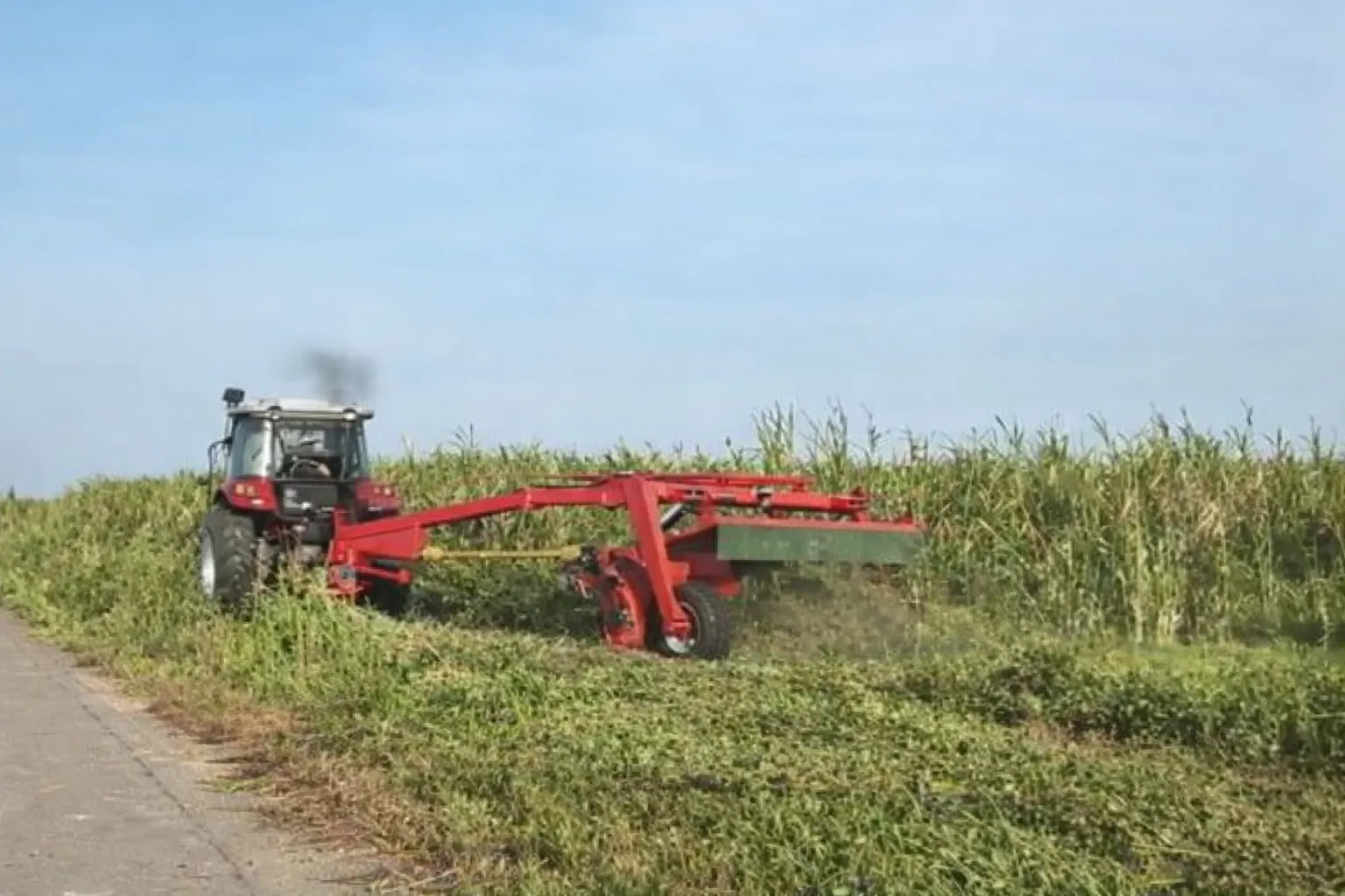
mower-conditioner in hay field — cutting decisions must be made 24–48 hours in advance to allow field scheduling; reading a 10-day forecast for hay cutting requires evaluating not just rain probability but also humidity, temperature, and wind speed for the curing period that follows cutting

A weather forecast for hay cutting is not just a rain probability check — it is a multi-variable curing period evaluation. The question is not “will it rain on the day I cut?” but “will the 48–72 hour period after cutting provide enough drying potential to bring this crop to baling moisture before the next rain event?”

Reading a Forecast for Cutting — the 5-Step Evaluation
1

Identify your required drying window. First-cut alfalfa needs 48–72 hours to reach baling moisture in good conditions; lighter second or third cuttings need 24–48 hours. Identify the hours needed from cut to baling based on your crop, stand density, and conditioning equipment.

2

Check rain probability for the full drying window. Any day with precipitation probability above 30% within your required drying window is a risk. The exact threshold depends on your risk tolerance and crop value — for Premium export alfalfa, 20% precipitation probability may be the threshold. For livestock hay, 40% may be acceptable.

3

Check daytime RH and temperature for each day of the window. If forecast daytime RH is consistently above 65% even without rain, drying will be slow. Two overcast 70°F days with 65% RH will not dry alfalfa to baling moisture reliably even without a rain event. Insufficient drying potential is a quality risk even without direct rain.

4

Check overnight dew point for each night in the window. Overnight dew point above 60°F causes significant moisture reabsorption in partially dried hay — the crop that was at 22% moisture at 7 PM may be at 28% by 7 AM the next morning. High overnight dew point extends the required drying window by 8–12 effective hours per night.

5

Confirm the post-window weather. What follows your planned baling window matters. If baling conditions look good but rain is forecast 12 hours after your planned baling time, any delays in baling leave the crop exposed. Build a buffer between planned baling time and the next rain risk.

Dew Point and Overnight Reabsorption: The Variable Forecasters Often Miss

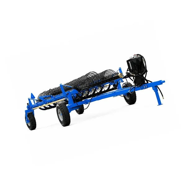
hay raking operation — overnight dew reabsorption is the primary reason morning hay moisture readings are higher than the previous afternoon readings; understanding the dew point forecast determines whether an afternoon baling window is achievable before overnight reabsorption resets the moisture

Dew point temperature is the temperature at which the air becomes fully saturated — when air cools to the dew point, moisture condenses on surfaces. When the overnight air temperature drops to the dew point, hay in the field absorbs moisture from the air through the same vapor pressure gradient that drives daytime drying, but in reverse. A crop that dried to 16% moisture by sunset can absorb enough atmospheric moisture overnight to return to 22–26% by early morning.

Low dew point (<50°F) — favorable overnight

Overnight dew points below 50°F produce minimal moisture reabsorption. The crop may gain 1–3% moisture overnight from slight condensation but dries back rapidly in the first 1–2 hours of the next morning. In arid western climates where summer dew points are consistently 30–45°F, hay can sometimes be baled in the early morning after an overnight drying period without significant reabsorption concern.

High dew point (60–70°F) — significant reabsorption

In humid midwestern and eastern regions where summer dew points are consistently 60–70°F, overnight reabsorption is a major yield and quality factor. Hay that dried to 18% by 5 PM can return to 28–32% by 7 AM the next morning. This means the effective drying window is only the daylight hours — and baling must occur before dusk on the day the crop reaches baling moisture, not the following morning. Plan baling schedules around this constraint in high-dew-point climates.

Practical rule for high-dew-point climates: When overnight dew point forecast is above 60°F, bale before 6 PM on the target baling day — do not leave cut hay in the field overnight expecting to bale at 8 AM the next morning. The overnight reabsorption will have reset the moisture and the next afternoon becomes the baling target instead, adding 12–18 hours to the total field exposure time.

Regional Hay Drying Patterns: How Climate Zone Changes the Strategy

Intermountain West (CA, ID, NV, UT, CO)
Low humidity, low dew point, high solar radiation. Fastest drying conditions in the U.S. — first-cut alfalfa can reach baling moisture in 18–28 hours under ideal summer conditions. Risk: sporadic afternoon thunderstorms from July onward; isolated storm cells can affect a field without appearing on regional forecasts. Strategy: cut early in the week, bale Thursday; avoid cutting into weekend weather uncertainty in convective storm season.
Pacific Northwest (OR, WA)
Variable — excellent June–August windows with low humidity and long daylight; challenging September–October with increasing marine layer influence. Primary hay cutting season is narrow (June–August). Strategy: prioritize weather windows in June–July over stand-age cutting schedules; second-cut decisions in August require 5-day forecast confidence; avoid September cuts unless irrigated and protected fields.
Upper Midwest (MN, WI, MI, IA)
High summer humidity, high dew points (60–70°F typical), moderate solar radiation. 48–72-hour drying windows are typical; overnight reabsorption is significant. Strategy: target 3+ day windows with low RH and afternoon winds; avoid cutting on Friday when weekend weather often deteriorates; track dew point forecast as closely as rain probability in cutting decisions.
Northeast (NY, PA, VT, NH)
Most challenging hay drying climate in the U.S. — persistent humidity, frequent convective storms, high dew points throughout the season. More producers use preservatives, tedding, or silage systems here than in any other U.S. region. Strategy: prioritize 3-day windows; use mower-conditioner at maximum conditioning intensity to minimize required drying time; consider inoculant-wrapped bale silage for high-risk cuttings.
Central Plains (KS, OK, NE, SD)
Good summer drying with low humidity after frontal passages; challenging during heat dome events with high RH. Native grass and brome hay makes up significant production. Strategy: bale immediately after frontal passage when humidity drops — these post-front windows (18–36 hours) are the highest-quality production opportunities. Track wind shifts as indicators of frontal passage timing.

The Best Weather Data Sources for Field-Level Hay Decisions

National Weather Service forecasts are adequate for 3-day planning but have spatial resolution of 2–5 miles — a thunderstorm that misses your field shows up in the forecast because it hit a station 4 miles away. For hay cutting, field-level accuracy matters more than for most agricultural decisions. The sources that provide the best field-level accuracy are ranked here by specificity and agricultural relevance.

Agricultural weather services

Services such as DTN/Progressive Farmer, AgWeather, and Climate Corporation offer field-specific forecasts with hourly RH, temperature, wind, and precipitation probability. Many include a “hay drying index” or equivalent composite metric that translates the raw variables into a single drying potential score. These services are subscription-based but typically cost $100–$300/year — justified for operations where a single rained-on cutting represents $2,000+ in quality losses.

NOAA hourly forecast API

NOAA’s National Digital Forecast Database provides hourly forecasts for any GPS coordinate in the U.S. at no cost through api.weather.gov. The API provides temperature, RH, dew point, wind speed, precipitation probability, and sky cover for each hour, 7 days forward. A simple spreadsheet that inputs your field coordinates and pulls this data provides better field-level forecasting than any app for the drying period analysis described in this guide.

On-farm weather station

A simple on-farm weather station ($200–$600) recording temperature, RH, dew point, and wind gives the actual conditions at your field rather than forecast conditions. Historical on-farm records are the most valuable tool for calibrating forecast-to-actual differences specific to your location — learning your microclimate’s systematic biases from the regional forecast makes every subsequent cutting decision more accurate.

Rain Event Response: When a Rain Hits the Cut Crop

hay baling after rain event — when rain falls on cut hay, the response decision depends on how much rain fell, at what moisture level the crop was when rain hit, and whether the post-rain forecast supports recovery drying before a second rain event

A rain event during the curing period is one of the most common and costly problems in hay production. The response depends on the amount of rain, the crop’s moisture level when the rain hit, and the quality of the post-rain weather window. Not all rain events produce the same damage — a 0.2-inch shower on hay at 35% moisture is very different from 1.5 inches of rain on hay that had dried to 18%.

LIGHT RAIN (<0.3″)

On hay above 35% moisture: minimal additional damage — the crop was already wet and the rain adds limited total water. On hay at 15–25%: more damaging, as the rain rewets dried stems that had lost their waxy cuticle protection. Response: wait for surface dew to dry (typically 2–4 hours after rain stops), then ted if crop is above 30% moisture. Bale when moisture probe confirms target range.

MODERATE RAIN (0.3–1.0″)

Significant protein and soluble carbohydrate leaching occurs from rain contact on hay below 40% moisture. Quality loss is real and measurable on a forage test — expect 5–15 RFV point reduction on leached hay. After rain stops, allow at least 6 hours before entering the field to allow surface water to drain. Ted the windrow to accelerate re-drying. Test moisture before baling — rained-on hay often has non-uniform moisture with dry surface and wet core. If a second rain is forecast within 24 hours, consider baling at slightly elevated moisture with hay preservative to prevent further leaching.

HEAVY RAIN (>1.0″)

Heavy rain on curing hay causes major quality loss — leaching, physical damage to the mat structure, potential mold initiation at the windrow base, and a significant RFV reduction that drops Premium-grade hay to Good or below. Reassess market destination after a heavy rain event — hay that was intended for horse or export premium markets may need to be redirected to livestock feed markets at a lower price point. A forage test after re-drying provides the actual quality data needed for accurate market decisions.

The mowing and conditioning equipment settings that maximize drying rate and reduce the required window length — reducing weather risk exposure for every cutting — are in the mowing and conditioning quality guide. The quality management decisions throughout the harvest workflow that determine final hay grade are in the how to improve hay quality guide. The mower-conditioner PTO and gearbox specifications that determine conditioning intensity are in 농업용 변속기 및 PTO 구동계 부품 사양.

Cutting Timing Within the Day: Morning vs Afternoon Cuts

Morning cut (8–11 AM)

Cutting in the morning maximizes the drying time available on the first day. A crop cut at 9 AM has 8–9 hours of peak-sun drying before late afternoon humidity begins rising. The disadvantage: morning dew may still be present on the crop at cutting time, adding initial moisture load. Wait until dew evaporates from the crop surface (typically 8:30–9:30 AM in summer) before cutting to avoid mechanical dew-spread during mowing. A morning cut requires a corresponding morning rake and afternoon bale — the full workflow must fit within the single day’s drying window in high-dew-point climates.

Afternoon cut (1–4 PM)

Afternoon cuts allow dew evaporation before cutting but provide less same-day drying time. The advantage is that the mowed crop has the highest sugar content in the afternoon (photosynthesis has been running all day), which can support more efficient fermentation for silage applications. For dry hay production in humid climates, afternoon cuts produce less same-day progress than morning cuts. In arid western climates where overnight moisture reabsorption is low, afternoon cuts are viable since the crop dries adequately the following day without significant overnight setback.

Hay Drying Weather FAQs

How reliable are 7-day hay weather forecasts versus 3-day forecasts?+
Three-day forecasts are sufficiently accurate for cutting decisions in most regions — precipitation probability, temperature, and humidity forecasts at 72 hours have skill scores above 80% for most U.S. locations. At 5–7 days, accuracy drops to 60–70% for precipitation events, meaning a forecasted rain event at day 6 may or may not occur. Use 7-day forecasts for strategic planning (which week to target for cutting) but base the actual cut decision on the 3-day forecast confirmed the day before you plan to cut. In convective storm regions (Central Plains, Intermountain West), even 24-hour forecasts miss localized storm cells — the 3-day accuracy reference applies to regional weather patterns, not isolated afternoon thunderstorms.
What relative humidity level is too high to cut hay?+
There is no single RH threshold — it interacts with temperature and solar radiation. However, as a practical rule: if daytime RH forecast for all 3 days following the planned cut is above 65%, the drying rate will be insufficient for first-cut alfalfa to reach baling moisture before the next typical rain event in humid climates. A better threshold for cutting decisions is the vapor pressure deficit (VPD) — which combines temperature and RH into a single drying potential metric. A VPD above 1.0 kPa (roughly: temperature 75°F with RH below 55%, or 85°F with RH below 65%) indicates adequate drying potential. VPD is available in agricultural weather apps. If your region’s agricultural extension provides a “hay drying index” that already incorporates these variables, use that directly.
Can I cut hay in front of a rain system if I plan to wrap it as silage?+
Yes — silage baling in front of rain is a viable and commonly used strategy in wet climates and during unfavorable drying windows. The timing requirement is different from dry hay: cut, wilt to 45–65% moisture (typically 6–18 hours depending on conditions), bale, and wrap within 60 minutes of baling. For silage, rain falling during the 6-hour wilting period is more manageable than for dry hay — the crop is not attempting to reach 14–18% moisture, only 45–65%, so the rain’s dilution effect is smaller relative to target. The risk with cutting-into-rain for silage: if rain is heavy and prolonged, the crop may be too wet (above 70%) when you need to bale, producing effluent problems and butyric fermentation risk. Monitor wilting moisture with a probe and bale when you hit the target range regardless of whether rain has arrived, rather than trying to meet a time schedule.
Does wind direction matter for hay drying, or just wind speed?+
Wind direction matters through its association with air mass characteristics rather than from a direct physical drying effect. West and northwest winds following frontal passage typically bring low-humidity, high-dew-point air that is ideal for hay drying. South and southwest winds in the summer often bring humid, high-dew-point air from the Gulf of Mexico — the same wind speed from the south produces much slower drying than from the northwest because the air mass it is bringing is already near saturation. If your weather app or service provides wind direction, use it as an air mass indicator: northwest wind after a front is a “cut now” signal in many midwestern and central plains locations; sustained south wind before a front is a “wait” signal.
My neighbor always cuts 2 days before I do and consistently produces better hay. Why?+
Two days earlier cutting relative to the same weather window has two potential quality implications. First, your neighbor may be cutting at a slightly earlier maturity stage (bud to 5% bloom vs your 15–20% bloom) — the maturity difference alone accounts for 10–20 RFV points in quality outcome. Second, cutting earlier in the morning within the same day means more peak-sun drying on day one. If your cutting pattern is to cut mid-day and your neighbor cuts first thing in the morning, the extra 3–4 hours of first-day drying moves the baling window earlier the following day — reducing the chances of the crop being exposed to a late-afternoon weather change that catches your later-cutting field still out. Track bloom stage in your field and compare it to your neighbor’s cutting trigger to identify whether the maturity or weather window timing is the primary difference.
How much quality does one light rain event (0.2″) cause on half-dried alfalfa?+
A 0.2-inch rain event on alfalfa that had reached 25–35% moisture typically produces 5–10 RFV points of quality loss from protein leaching and cell-sap soluble carbohydrate loss. At 35% moisture the leaves are still turgid and some protection remains; at 20% the cuticle has broken down and leaching is more severe for the same rain volume. Research on single light rain events on alfalfa consistently shows RFV losses in the 5–15 point range for a single event. A second rain event before baling produces compounding losses — the second event leaches material that the first event’s redistribution exposed. The quality damage from even light rain is the reason experienced hay producers use “no rain within 48 hours” as a minimum threshold, not as a target. Each deviation from a clean drying window costs quality regardless of how small it seems.
foragebaler.com hay production equipment — mowing, conditioning, and baling systems that reduce required drying time and weather exposure risk at each cutting

Get Conditioning Equipment That Shortens Your Drying Window

Tell us your crop type, climate zone, and current drying time from cut to bale. We recommend the mower-conditioner configuration that reduces your required drying window and minimizes weather-exposure risk at each cutting.

Get Equipment Recommendation

편집자: Cxm